Over Haddon A mystery House Preliminary survey
A joint study by Over Haddon History Group and The Time Travellers Archaeology Group
1. Introduction
The residents at Over Haddon have recently set up a new local history group. Their early examination of old maps identified a possible significant house in the village which seems to have disappeared after 1720. The group approached The Time Travellers Archaeology group for help in confirming the location of the house and gleaning information about it.
There appears to be no archaeological record of, or examination of, the possible site area to date. As a first step the Time Travellers agreed to help with an initial site survey in an attempt to establish the exact location and whether any remains exist.
Permission was gained from the landowner. The archaeology team at the Peak Park Authority was informed of the discovery and will be copied in on all findings. It is hoped their involvement will aid subsequent research into the site and its history.
2. Methodology
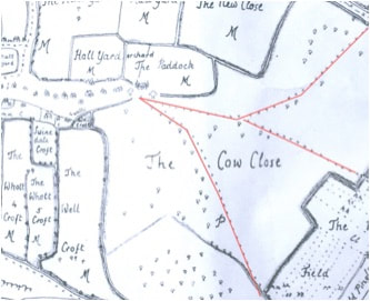
The Over Haddon History Group had already undertaken an examination of old maps and some local history records. These had established a sketch of a substantial building on an area that is now farmland to the eastern end of the village. The map was intended to be indicative rather than precise.
There is some suggestion from local knowledge, and in adjacent field walls and buildings, that building material from the site had been reused elsewhere.
It was felt a visual and physical examination of the site would hopefully confirm whether features were natural or man-made, whether the footprint of a building could be ascertained and whether any physical evidence remained.
3. Visual Survey
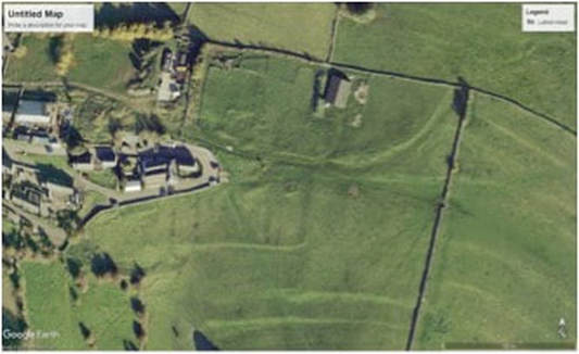
An initial visual examination of the site identified a large area of disturbance to the basic landform at the western end of the field containing the site. This takes the form of excavations into the natural slope at different locations and levels, along with a relatively recent elevated trackway across the site. There also appear to be scrapes and the deposition of material, along with projecting platforms.
Closer examination of the field showed what appears to have been an enclosed area down slope and to the south of the disturbance (garden?) while there is also evidence of landscaping to the rear. Immediately to the east of the site is a curving boundary trending north which appears to be a ha-ha around an area market as a paddock on the 1720 map.
4. Physical Survey
In order to ascertain whether disturbance was associated with a building site three one metre square test pits were dug at intervals on a north south line across the site. A fourth pit was located on the prominent forward facing platform. The turf was removed at each position and surface excavation made to establish the underlying material.(See diagram & pictures)
Pit One
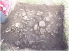
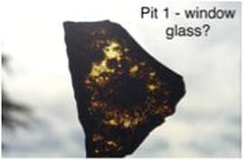
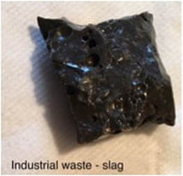
Sited at the back slope to the disturbed area.This revealed a jumble of loose limestone, sandstone and chert material intermixed with a small amount of degraded lime mortar and containing cavities. The only surface find was a thick square piece of what looks like glass slag material*. Local comments suggested this was a common find in gardens.
Test pit one suggests the collapsed remains of a retaining wall to the rear of a building.
Pit Two
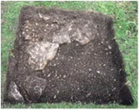
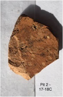
Under the surface soil were loose pieces of angular limestone, larger in part, with plenty of mortar and possible wall plaster. Limited pottery. This looked like demolition rubble and suggests we are in a previous building at this point.
Pit Three
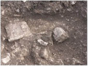
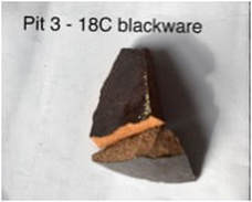
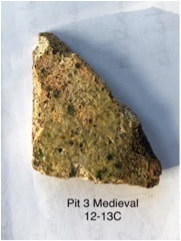
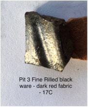
This is the only pit to possibly have evidence of a structure this stone slabs laid on each other and an edge of plaster (?) along one side. Several shards of pottery, possibly medieval. This pit stood forward of other visible site features. It may suggest parts of the building go under the later trackway.
Pit Four
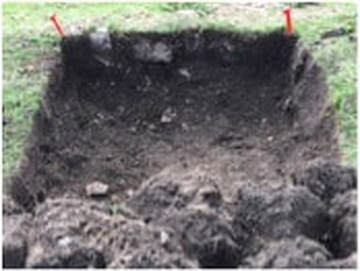
The pit consisted of loose soils, pieces of stone and different pieces of pottery. The insubstantial retaining wall and infill unlike test pits 2 or 3, suggests a garden frontage rather than a housing platform.
*All finds were bagged and washed before passing to a pottery expert for dating.
5. Pottery Finds
Notes from discussion with Chris Cumberpatch BA PhD on finds from Over Haddon Hall site
Finds date from 12C to 18C
No evidence of fine ware with white salt glaze which started production in second half of 18C
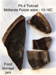
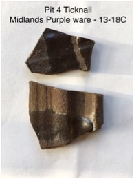
Finds are typical of Derbyshire, including a large proportion of kitchenware from Ticknall potteries
Fortunate to find medieval pottery as this is relatively rare in Derbyshire
Plaster looks like internal plaster
6. Conclusions and recommendations
The landform disturbances in the field would appear to belong to a substantial housing platform and associated garden works. Confirmation of this in association with the early map evidence means we have already added significantly to the known history of the village and the archaeology of the area!
The age of the pottery sherds are consistent with the literature evidence of a Hall being present from Henry VI reign (1422-1461) to mid 18C. The maps suggest the Hall was still present in ~1720 and had been demolished by 1808. There is no evidence of fine ware with white salt glaze which started production in second half of 18C.
The building must have been an important element in the history of the village. Questions remain as to when it was built, how big it was, its likely design, any phases of development and collapse, and why it fell into ruin?
The next logical step is a geophysical survey of the site to clarify its layout and extent. When the results of this and ongoing archive research are available, consideration should be given to excavations to clarify the extent of remains, their age and the materials used.
The Time Travellers Archaeology Group October 2018
Over Haddon History Group
List of Appendices
Appendix 1 Photographs of pits
Appendix 2 Google image of site
Appendix 3 circ 1720 map
Appendix 4 Pottery samples
Appendix 5 Family history
Appendix 1 Photographs showing extent of exposure in each pit
Test Pit 1 looking due north into slope. A jumble of loose limestone, sandstone and chert
material intermixed with a small amount of degraded lime mortar and containing cavities.
material intermixed with a small amount of degraded lime mortar and containing cavities.

